Le Réseau Alpin des Espaces Protégés

The Chapter "Evaluating Management Effectiveness of National Parks as a Contribution to Good Governance and Social Learning" is available online at this link (or see below).
Michael Getzner
Center of Public Finance and Infrastructure Policy,
Vienna University of Technology, Vienna, Austria
Michael Jungmeier
ECO Institute of Ecology, Klagenfurt, Austria
Bernd Pfleger
Experience Wilderness, Enns, Austria
20/09/2012 - Evaluation-efficiency Evaluating Management Effectiveness of National Parks
Chapter "Evaluating Management Effectiveness of National Parks as a Contribution to Good Governance and Social Learning" written by Michael Getzner, Michael Jungmeier and Bernd Pfleger
We are pleased to provide you here a first list of events organized or co-organized by ALPARC and important dates to remember in 2012.
|
12-15 January |
|
|
1-2 March |
ALPARC International Steering Committee – Monaco (MC) |
|
4 September |
|
|
5-8 September |
|
|
17-18 October |
Workshop Mountain Environmental Education – Hohe Tauern National Park, Mallnitz (A) |
|
Other events and meetings could still be programmed. Don’t forget to check regularly the calendar of events at the website of Alparc. You can also stream your own events on this site, under " Events of the Alpine protected areas " and "Other events in the Alps ": for this, you have simply to provide us all useful information: info@alparc.org |
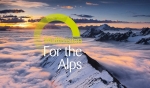
The "For the Alps" multivision is an ALPARC project undertaken in conjunction with 20 network partners. It was created by Alex Rowbotham (AGR Digital Media) and set to original music by Sandro di Stefano. The production contains over 400 original photographs, most of which were taken by staff from the Alpine parks.
The media experience was premiered on 24 May 2012, the European Day of Parks. Over the summer, it was screened by our partners in six Alpine countries. The multivision production was then presented as part of AlpWeek 2012, which was held this September in Poschiavo (Switzerland).The multivision production is now available for use by all protected area managers in the ALPARC network.
Visit the website : multivision.alparc.org
Director : Alex Rowbotham, AGR Digital Media, www.agrfoto.com
Original music composed by : Sandro Di Stefano
An ALPARC production
Original work designed by 20 partners from 6 Alpine countries: Austria, France, Germany, Italy, Slovenia, Switzerland
Nearly all photographs were taken by staff from the Alpine protected areas
Running time: 23 minutes
Available in 5 languages: English, French, German, Italian and Slovenian
The production will touch any and everyone.
High-definition files are already available for you to download from the dedicated multivision website . You will need to register in order to access the files (Sign in > Register). Once your registration has been approved (you will receive a confirmation email within 48 hours), you will be able to access the private download area.
You can access:
If you are planning a screening in your area, please notify ALPARC and enter the details on the multivision website. Simply sign in to publish details of your event using the online calendar .
For the Alps will also be available in DVD and Blu-ray format by the end of 2012. A free copy will be sent to all Alpine protected areas.The low-definition version is ideal for use with DVD players and will complement the high-definition versions (.exe and .mp4 files) suitable for large screens.
All the Alpine protected areas are invited to make the most of this collaborative project by including it in their programming for 2013.
If you have any questions, please contact Marie Stoeckel, +33 (0)4 79 26 55 00 or multivision@alparc.org
Financing: The multivision productions was co-financed by the partner protected areas who helped to create it (listed here )and by:
Climate Change and anthropogenic activities are challenging European habitats and their management.Especially protected areas are confronted with the pressing need to monitor changes, adapt management strategies and consider flexible responses to future developments.
The aim of the conference is to bring together researchers, conservation managers and decision-makers in the field of nature conservation.It provides a platform for dialogue to develop a better understanding of the complex impacts of climate change on biodiversity on local level and the means to adapt management in protected areas accordingly.
We anticipate 150 international participants to enjoy two days of technical sessions, workshops, poster exhibits and social activities, and one day of excursions.
Topics:
One of the conference aims is to found the association "Climate Change and Protected Areas". This association should serve as a sustainable network for transdisciplinary exchange of experts in this field.
For further information, please click on the following link: http://www.habit-change.eu/index.php?id=200
Der Nationalpark Kalkalpen lädt zusammen mit dem Wildnisgebiet Dürrenstein, Nationalparks Austria, dem WWF und dem Naturschutzbund zu Wildnistagen im Nationalpark Kalkalpen ein.
Unter dem Motto „Wilde Vielfalt“ verbringen die TeilnehmerInnen drei Tage und zwei Nächte in der Waldwildnis des Nationalparks und nächtigen in einfachen Unterkünften. Begleitet von Experten nähert man sich in verschiedenen Ansätzen der „Wildnis“ im Nationalpark Kalkalpen.
Folgende Themen stehen zur Auswahl:
1.) Wildnisvermittlung – Wildnisangebote,
2.) Indikatoren der Wildnis oder
3.) Verwildern - braucht Wildnis ein Management?
Für weitere Informationen und Anmeldung kontaktieren Sie bitte das Nationalpark Zentrum Molln, Nationalpark Allee 1 in 4591 Molln unter 0043 (0)7584/3951 oder per Email.
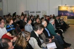
Around 50 people met on Thursday 6 and Friday 7 September 2012 at Poschiavo (CH) for the General Assembly of the ALPARC network, providing the opportunity for its president, Michael Vogel, to present the latest developments in the structure of the ALPARC network, and to initiate its transition towards a future ALPARC association.
After the speech given by President Michael Vogel, in which he stressed the importance of the work of the ALPARC network in alpine international cooperation, the afternoon of Thursday 6 September was dedicated to the presentation of the new statutes for the future ALPARC association.
ALPARC needs a legal basis and structure in order to be able to implement larger shared projects, but also and above all in order to give a greater image and international weight to the protected areas of the Alps. The principal leitmotiv, however, remains the provision of concrete, efficient and grounded contributions towards the application of the Alpine Convention and its protocols, especially as regards the “Protection of nature and safeguarding of landscapes”.
Due to a first transmission of the statutes in July, all members had the possibility to present their remarks and observations. During the General Assembly, a general accordance could be found about the new ALPARC statutes. For certain countries, the entry to the new association needs to clarify administrative procedures, which should be resolved before 2013.
At the end of the discussions, the members were invited to share an Alpine aperitif and so discover and taste some of the specialities of the Alps. In the evening, they were invited to the screening of the new “For the Alpes” Multivision .
Information: ALPARC currently enjoys the support of numerous financial partners: the French ministry for Ecology, Sustainable development and Energy, the two French Alpine regions – PACA and Rhône Alpes – DATAR, the town of Chambéry, together with the German BMU ministry, the Swiss Confederation, the principalities of Monaco and Liechtenstein and the MAVA and Heidehof Foundations, as well as the European Union.
The morning of Friday 7 September was dedicated to the presentation of the actions undertaken in2011-2012 . Organised in the form of a World café, the discussion and exchanges saw the emergence of new perspectives and avenues for the actions to be effected in forthcoming years. This was followed by the presentation of the new programme of projects for the transitional year of 2013 (see below).
The afternoon of the Friday, 7 September, was marked by a common declaration from the protected areas present at the General Assembly indicating their desire to create an ALPARC – Alpine Network of Protected Areas:
“Aware of the ecological, economic and social stakes, and appealing for a better coordination and coordination of the actions implemented throughout the Alps, the protected Alpine areas and territorial communities signing the present declaration have decided to pool their reflections in order to create the ‘ALPARC – Alpine Network of Protected Areas’ association, a tool of Alpine cooperation”.
This declaration marks the first step towards the new association, which should become established in law during the course of 2013.
ALPARC is pleased to invite you to present your latest protected areas research at the next international Symposium for Research in Protected Areas, 10-12 June 2013.
This event aims at providing researchers and staff of conservation organizations with an opportunity to exchange valuable information, new ideas as well as common interests and to discuss a variety of current research and management issues in protected areas.
The symposium will take place at the Hohe Tauern National Park Center in Mittersill, Salzburg, Austria.
The Concept
Six of Austria’s most ecologically valuable regions have been designated as national parks. They reflect the great diversity of this central European country: high mountains, forests, water and riparian marshes and steppes. Austria is part of two biogeographic regions: the alpine and the continental, and most of the Austrian national parks are part of two important regional networks: ALPARC (Alpine Network of Protected Areas) and DanubePARKS (The Danube River Network of Protected Areas ).
In close cooperation with these regional networks for protected areas, and further supported by scientific institutions - ISCAR (International Scientific Committee on Research in the Alps), IGF (Mountain Research: Man and Environment, an Institute of the Austrian Academy of Sciences (ÖAW )) and IAD (International Association for Danube Research) - we are looking for input from researchers or research groups working on issues related to protected areas across the entire geographic region from the Western Alps to the Danube Delta, from the plains to the highest peaks in Europe, from glacier-fed torrents to one of the world’s biggest wetlands.
Guiding Theme
Dynamics and conservation in protected areas - challenges for research and management.
At the 2013 conference itself, we would like to focus attention on:
Dynamics and conservation in protected areas under conditions of global change and the need to protect diversity.
- Do protected areas achieve the objectives defined for the protection of processes, functions and diversity and where are the limits?
- What are currently the most relevant research priorities, research questions, methods and recent results – regional and supra-regional, short and long term?
- Long-term ecosystem research: What do we know from science and practice?
- Where do protected areas, their regions and their networks currently stand regarding research and management?
We invite you to contribute to our Symposium by giving a talk or presenting a poster.
The call is open until 12 October 2012 for any topic that relates to the guiding theme.
Call for Papers
If you are interested in presenting your current research at the symposium, we kindly ask you to bear in mind the following information and timetable:
- Conference language: English only
- 12 October 2012 – Deadline for submitting an application with a short description of your presentation (max. 1.800 characters, incl. spaces) and a short Curriculum Vitae. Please use the attached or the online registration form: www.hohetauern.at/symposium2013 (available from 23. July 2012).
- 14 December 2012 – Announcement of accepted contributions (talk and/or poster/-s) and approved thematic sessions by the Scientific Board.
- January 2013 – Announcement of the full programme set by the Scientific Board.
- 25 February 2013 – Deadline for submitting your abstract for the conference proceedings. Detailled information will follow after acceptance.
Registration / Submission of papers
Secretary of the Conference
Hohe Tauern National Park
Gerlos Straße 18/2
A 5730 Mittersill
e-mail: nationalpark@salzburg.gv.at
phone: +43 (0)6562 40849
Further information, registration form and submission form:
www.hohetauern.at
The Alpine Week 2012 was held from 5 to 8 September in the Valposchiavo in Switzerland. The theme chosen for this year was “Renewable Alps”. For the first time in the history of the Alpine convention, the Alpine conference, which brings together the Ministers of the signatory states, took place during the Alpine Week.
The Alpine Week is one of the most important events for sustainable development within the Alpine range, bringing together French, Italian, Swiss, German, Austrian, Slovene and Liechtensteiner protagonists of all the major Alpine research networks (ISCAR ), districts (Alliance in the Alps ), NGOs (CIPRA ), protected areas (ALPARC ) and alpine clubs (CAA ).
At the centre of the week: the Alps and their protagonists. The aim: to inject new energy into existing initiatives for sustainable development in the Alps and encourage new ones. The idea of having the Alpine protagonists and representatives of the signatory states to the Alpine convention together under one roof proved a fruitful one. This meeting, has made it possible to encourage the emergence of new solutions and dynamics in mountain partnerships.
During the numerous thematic sessions held in parallel (about 30 in all), the participants at the Alpine Week were able to discover a wide range of sustainable initiatives in the Alps and explore themes as varied as the young, schooling, governance, carbon neutrality, mobility, architecture, light pollution, landscape, agriculture, businesses, tourism, immigration and the brown bear.
A great success, therefore, thanks also to the committed involvement of the Valposchiavo region which, with its numerous assets, succeeded in creating an auspicious and exemplary framework for the theme of renewable Alps.
The new International Steering Committee (ISC) was elected during the ALPARC General Assembly held on 7th September 2012 at Poschiavo in Switzerland.
Michael Vogel, director of the Berchtesgaden National Park in Germany was re-elected to the chair of CPI until the next General Assembly which will mark the creation of the new ALPARC association. He will be supported in his work by two deputy chairmen: Alain Brandeis, director of the Mercantour National Park in France, who has already held this post for the past year, and Massimo Bocca, director of the Mont Avic Regional Nature Park . All three were elected unanimously.
The ISC comprises 16 members and an observer representing the protected areas in the 8 Alpine countries. It defines the general outlook underscoring the cooperative work on the basis of the priorities and requirements of the protected areas. Every two years, it draws up the ALPARC works programme, which is subsequently approved by the Permanent Committee of the Alpine convention .
As protected Alpine area, you may contact one of your national representatives directly for any further information or request.
Das 1. Roggenfest wird vom Verein Erlebniswelt Roggen organisiert und ist mehr als ein Fest: es ist ein Meilenstein auf dem Weg, Erschmatt als Zentrum des Roggens zu positionieren.
Die Aktivitäten während und rund um das Fest, sowie die Vernetzung mit den Roggen- und backbegeisterten Gästen aus Rauris/ A , ist eine nachhaltige Investition in eine urtümliche Walliser Tradition, die mit neuen Ideen ergänzt und lebendig weiter gegeben wird.
Reservieren Sie sich bereits jetzt dieses Datum. Es lohnt sich.
Ein Fest für alle Sinne! Kulturelles, Kulinarisches, Wissenswertes rund um den Roggen und seine Vielfalt warten am 8. September in Erschmatt auf Sie!
Infos unter: www.erschmatt.ch
en collaboration avec l’ASDER, PRIORITERRE, les organisations professionnelles, TENERRDIS et l’INES et la commune de Lescheraines.
Les thèmes sont: les économies d’énergies dans l’habitat et le transport, les énergies renouvelables et l’éco-construction adaptées aux spécificités du PNR du massif des Bauges
The next General Assembly of the network ALPAR C will take place on September, 6-7th 2012 in Valposchiavo (CH). This day will be a very special one for the network, because on this occasion, the ALPARC Association will be created.
It is one step that allows ALPARC to structure and close cooperation and legally binding to the Alpine Convention and still to maintain a strong self-reliance as a club. This step is the increasing number of projects and requests of protected areas can be coordinated more effectively. The only currently known solution of such a large "community" as the network it represents a legal status is to announce the founding of an association.
The 8th General Assembly of the Alpine Network of Protected Areas (ALPARC) will take place during the AlpWeek 2012.